
Case Studies Forestry and Urban Tree Management projects
Urban Forest Tree Mapping – Melbourne
Objective of the Project:
Between 2009 and 2012 different suburbs of Melbourne engaged Dimap to collect multisensory data using thermal, Hyperspectral, Lidar, and image sensors to provide data for the government GIS system. Some councils required support data for their tree cadastre including tree species/families and height data.
Technical Solution:
During the multisensory flight, Dimap collected VNIR Hyperspectral data with a resolution of 0.6m and an absolute accuracy of better than 1m and 4 pts/sqm Lidar data. The Hyperspectral data contained 160 bands. In the first step, Dimap calculated 19 different vegetation indices describing vegetation activities, health, and stress. This data was fused with the Lidar data to identify individual tree objects.
Using classical and object-based classification procedures tree families and the species of the most common trees were identified and vectorized as GIS layers including height, canopy diameter, and height of the individual trees. Due to the similarity of some Eucalyptus species, a complete separation of all species was not possible. For the classification of the families, the results had 88% to 99% confidence, for the most common species the classification accuracy was better than 95%.
Achievements:
Besides other layers for the council, GIS Dimap provided layers identifying trees in their spatial extension, their parameter, and their families and species. The collection of the data took 2 days of flying and reduced the effort for the arborists doing the groundwork significantly while location and major measurements for each tree were available.
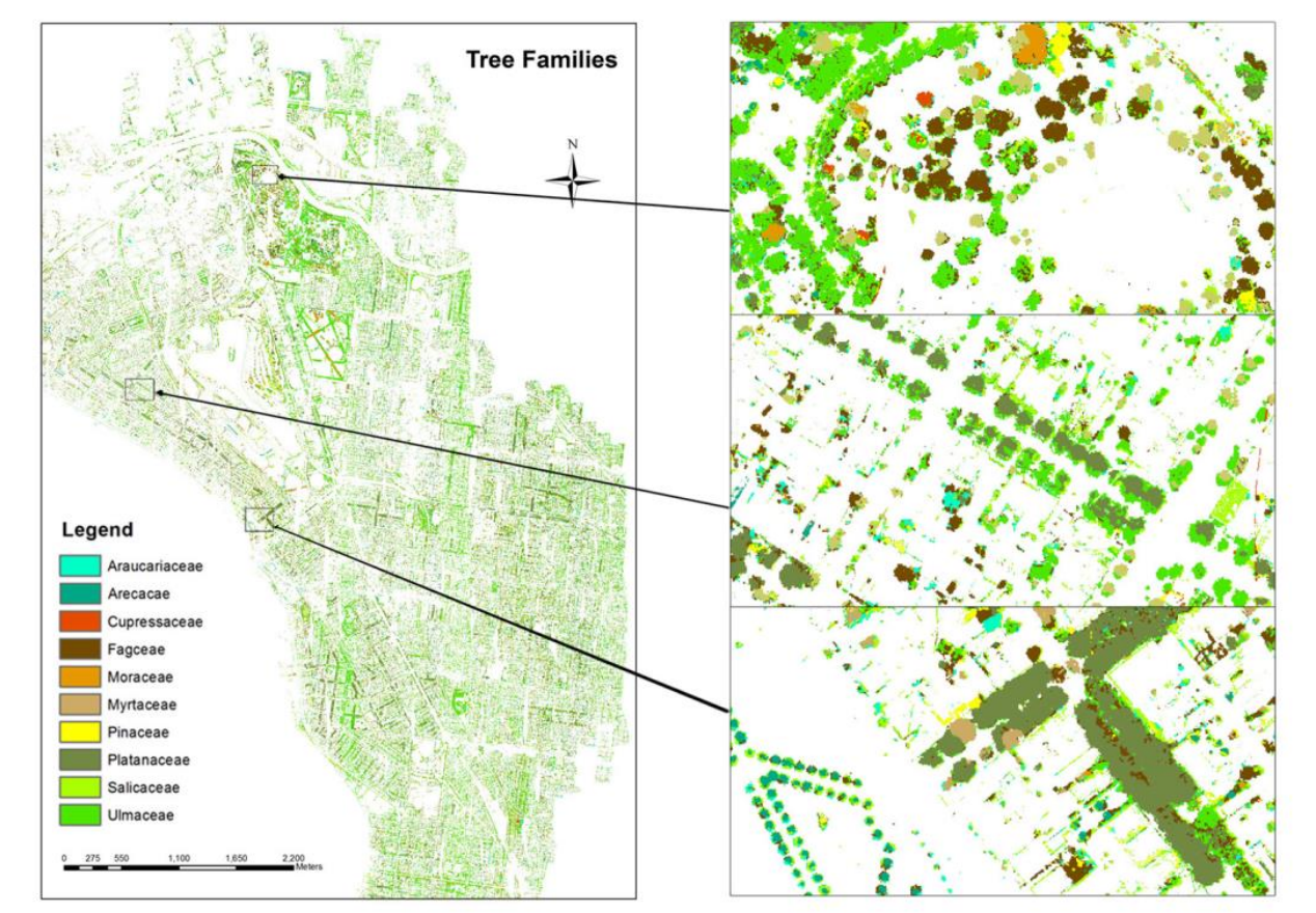
Figure 11: Tree families – GIS layer in one of the Melbourne councils.
All copyrights with Dimap – 2014