
Dimap successfully completed a collaborative mapping mission on Mount Kilimanjaro, Tanzania, Africa, utilizing an integrated sensor suite including LiDAR, RGB cameras, thermal imaging systems, and VNIR hyperspectral sensors.
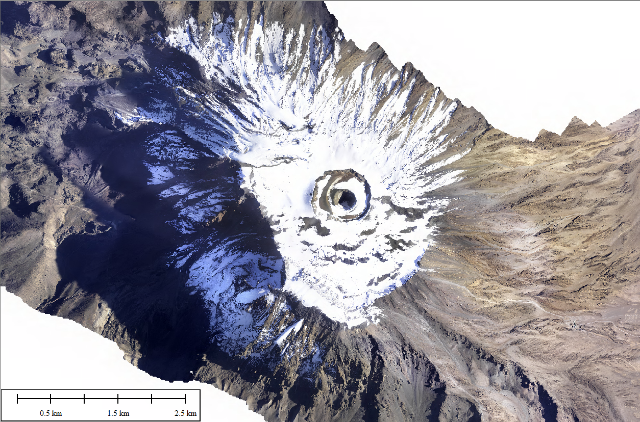
Figure 1: Mount Kilimanjaro Images
A preliminary dataset from the mission was showcased on 28 February 2025 at the summit of Mount Kilimanjaro, the highest geographical point in Tanzania and the African continent.
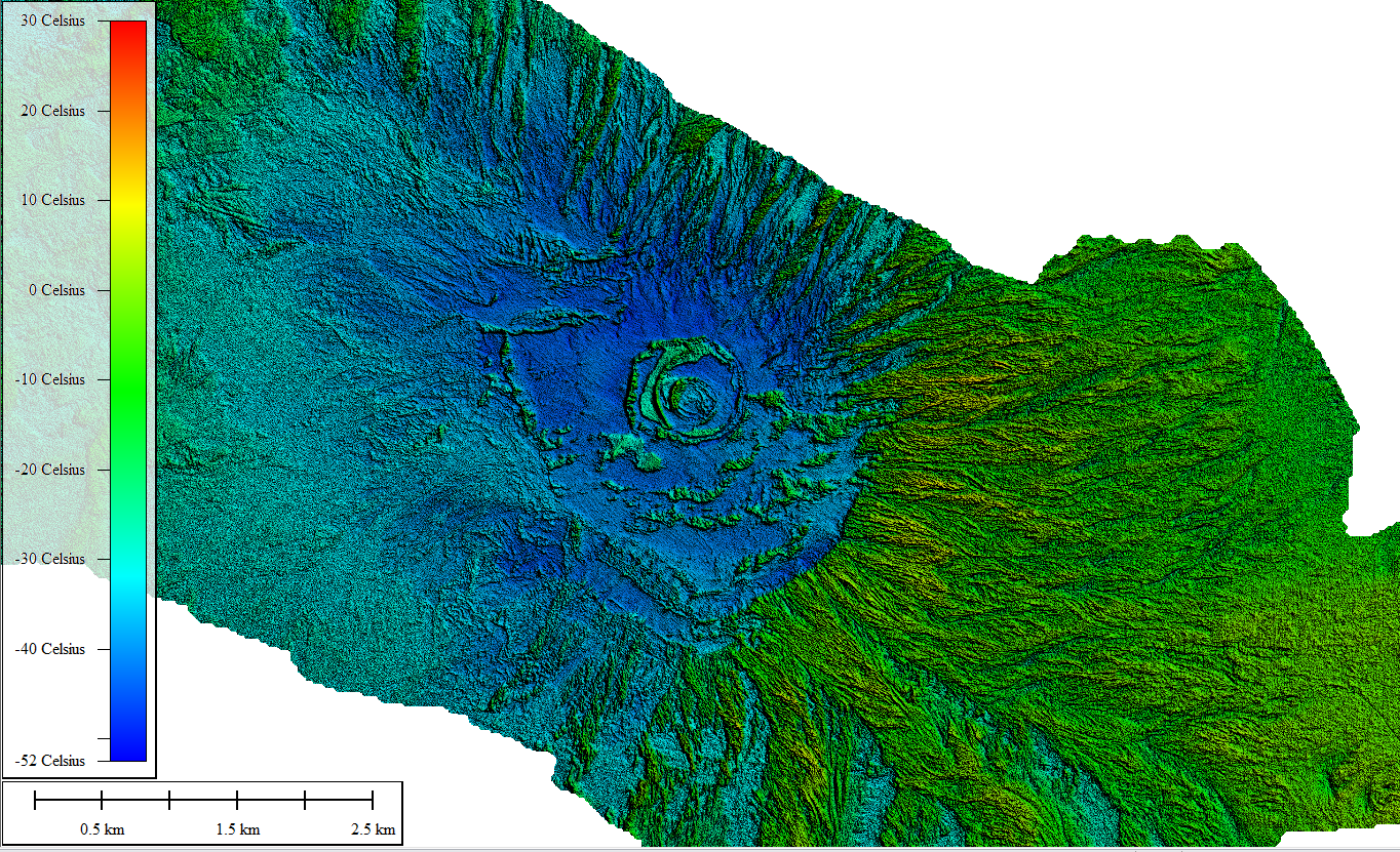
Figure 2: Thermal Images of Mount Kilimanjaro
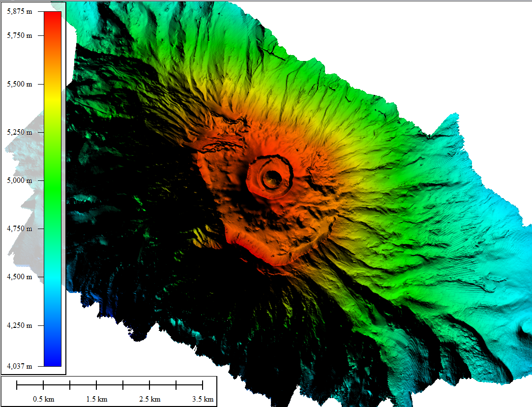
Figure 3: DTM of Mount Kilimanjaro
All copyrights with Dimap