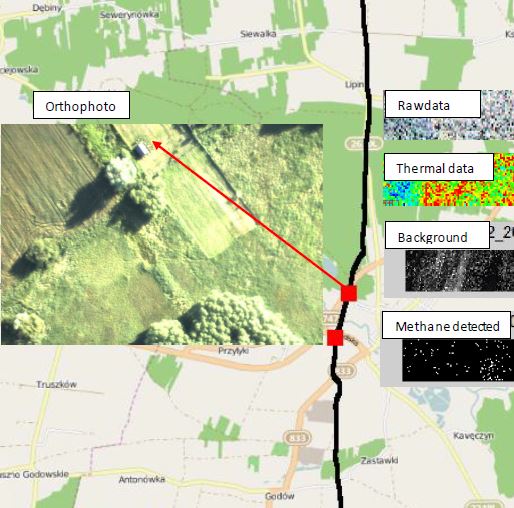
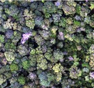
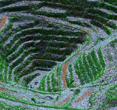
Skip to content
Dimap

Dimap

home

  • Front page
  • NEWS
  • About us
  • Services
    • UAV/Drone Survey
    • Forestry and Environmental Mapping
    • Mineral exploration and mine mapping
    • Engineering support
    • Urban Planning & Development
  • Equipment
    • Digital Camera
    • Lidar
    • Thermal
    • Hyperspectral Instruments
    • Multispectral Sensor
  • Further information
    • CoreSmart(Machine Learning)
    • Radar
    • Lidar
    • Thermal
    • Hyperspectral Theory
  • Operation
    • Auckland
    • Kilimanjaro
  • Case Studies
    • Environmental
      • Asbestos Pollution Mapping – NSW Australia
      • Dust Pollution Mapping – Namibia
      • Water Pollution – Hong Kong open seas
    • Forestry
      • Forestry Tasmania Usage of full waveform Lidar in forestry taxation
      • Rainforest Mapping – Malaysia
      • Ramin Tree Detection – Pekan Rainforests – Malaysia
      • Urban Forest Tree Mapping – Melbourne
    • Geotechnical
      • Dead Sea Potash Production – Dyke stability and water seepages
    • Glacier Survey
    • Pipeline Monitoring
      • Dimap Brochure gas
      • Dimap Brochure Lacq results
      • Dimap Brochure lublin
    • Mapping of Ramin Distribution
    • Mine Survey
      • Airborne Remote Sensing
  • Contact us
Dimap

Dimap

home

  • Front page
  • NEWS
  • About us
  • Services
    • UAV/Drone Survey
    • Forestry and Environmental Mapping
    • Mineral exploration and mine mapping
    • Engineering support
    • Urban Planning & Development
  • Equipment
    • Digital Camera
    • Lidar
    • Thermal
    • Hyperspectral Instruments
    • Multispectral Sensor
  • Further information
    • CoreSmart(Machine Learning)
    • Radar
    • Lidar
    • Thermal
    • Hyperspectral Theory
  • Operation
    • Auckland
    • Kilimanjaro
  • Case Studies
    • Environmental
      • Asbestos Pollution Mapping – NSW Australia
      • Dust Pollution Mapping – Namibia
      • Water Pollution – Hong Kong open seas
    • Forestry
      • Forestry Tasmania Usage of full waveform Lidar in forestry taxation
      • Rainforest Mapping – Malaysia
      • Ramin Tree Detection – Pekan Rainforests – Malaysia
      • Urban Forest Tree Mapping – Melbourne
    • Geotechnical
      • Dead Sea Potash Production – Dyke stability and water seepages
    • Glacier Survey
    • Pipeline Monitoring
      • Dimap Brochure gas
      • Dimap Brochure Lacq results
      • Dimap Brochure lublin
    • Mapping of Ramin Distribution
    • Mine Survey
      • Airborne Remote Sensing
  • Contact us
  • Home
  • Case Studies

Case Studies


environment_pdf


Environmental


forestry_pdf


Forestry


geotechnical_pdf


Geotechnical


gracier_pdf


Glacier Survey

pipeline_pdf


Pipeline Monitoring


Ramin_pdf


Mapping of Ramin Distribution


environment_pdf


Mine Survey

All rights reserved with Dimap, for technical details contact: Holger.Eichstaedt@dimap-spectral.com

Research Adriana

Airborne mineral exploration research


CoreSmart 2

AI predictor for metal contents in drill core and above


Researches

Dimap supports researches in a wide variety of projects, click here to see samples of recent publications


Carbon

Airborne measurement and modelling of above and below ground carbon with multisensory approach

Dimap

  • Front page
  • About Us
  • NEWS
  • Contact us
    Powered by the Dimap