Dimap 利用包括 LiDAR、RGB 摄像机、热成像系统和 VNIR 高光谱传感器在内的集成传感器套件,成功完成了对非洲坦桑尼亚乞力马扎罗山(Mount Kilimanjaro)的测绘任务。
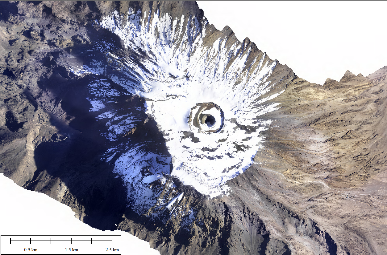
图 1:乞力马扎罗山(Mount Kilimanjaro)图像
2025 年 2 月 28 日,该任务的初步数据集在坦桑尼亚和非洲大陆的最高点乞力马扎罗山(Mount Kilimanjaro)顶峰进行了展示。
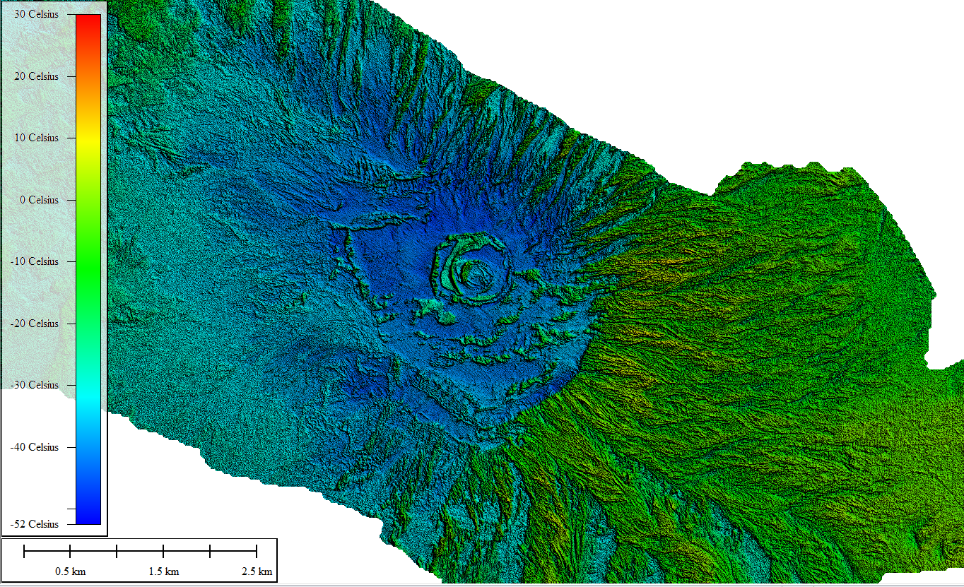
图2:乞力马扎罗山(Mount Kilimanjaro)的热像
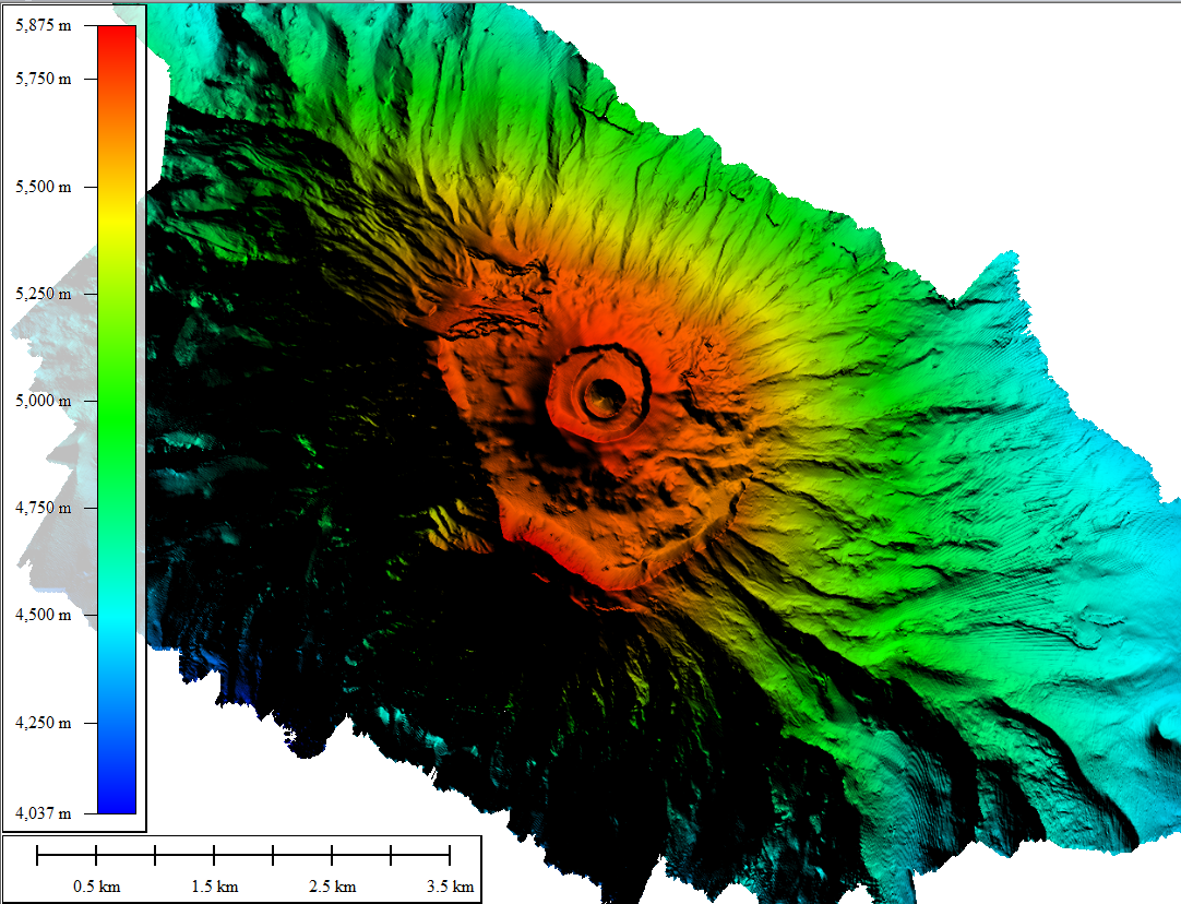
图 3:乞力马扎罗山(Mount Kilimanjaro)的 DTM
All copyrights with Dimap